En
Log in
All resources
Create a design
Tools
7,118 Free Images of Engraved Maps
copper engraving print
british library
joan blaeu
atlas maior, vol 3 (germany) - joan blaeu, 1667 - bl 114.h(star).3
maps from the earth and its inhabitants, vol. xvii
maps from the earth and its inhabitants, vol. viii
engraving
maps from the earth and its inhabitants, vol. xii
cartography
chalcography
map collection of leibniz-institut für länderkunde
dheulland map of paris
dheulland map of paris
map collection of leibniz-institut für länderkunde
dheulland map of paris
de praecipvis totivs vniversi vrbibvs, liber secvndvs (1575)
maps of vejer by braun & hogenberg
de praecipvis totivs vniversi vrbibvs, liber secvndvs (1575)
maps of corfu by braun & hogenberg
print room of the university of antwerp
kaarten van vlaanderen (prentenkabinet)
eran laor cartographic collection
jean-claude richard de saint-non
lithographs in the british museum
john raphael isaac
de praecipvis totivs vniversi vrbibvs, liber secvndvs (1575)
maps of oxford by braun & hogenberg
de praecipvis totivs vniversi vrbibvs, liber secvndvs (1575)
maps of konstanz by braun & hogenberg
de praecipvis totivs vniversi vrbibvs, liber secvndvs (1575)
maps of conil by braun & hogenberg
atlas maior, vol 3 (germany) - joan blaeu, 1667 - bl 114.h(star).3
copper engraving print
atlas maior, vol 3 (germany) - joan blaeu, 1667 - bl 114.h(star).3
copper engraving print
atlas maior, vol 2 (sweden, russia, poland, eastern europe, and greece) - joan blaeu, 1667 - bl 114.h(star).2
copper engraving print
atlas maior, vol 3 (germany) - joan blaeu, 1667 - bl 114.h(star).3
copper engraving print
atlas maior, vol 1 (northern europe, norway, and denmark) - joan blaeu, 1667 - bl 114.h(star).1
copper engraving print
atlas maior, vol 3 (germany) - joan blaeu, 1667 - bl 114.h(star).3
copper engraving print
atlas maior, vol 3 (germany) - joan blaeu, 1667 - bl 114.h(star).3
copper engraving print
atlas maior, vol 3 (germany) - joan blaeu, 1667 - bl 114.h(star).3
copper engraving print
atlas maior, vol 1 (northern europe, norway, and denmark) - joan blaeu, 1667 - bl 114.h(star).1
copper engraving print
atlas maior, vol 3 (germany) - joan blaeu, 1667 - bl 114.h(star).3
copper engraving print
atlas maior, vol 3 (germany) - joan blaeu, 1667 - bl 114.h(star).3
copper engraving print
atlas maior, vol 3 (germany) - joan blaeu, 1667 - bl 114.h(star).3
copper engraving print
atlas maior, vol 3 (germany) - joan blaeu, 1667 - bl 114.h(star).3
copper engraving print
atlas maior, vol 2 (sweden, russia, poland, eastern europe, and greece) - joan blaeu, 1667 - bl 114.h(star).2
copper engraving print
atlas maior, vol 4 (netherlands) - joan blaeu, 1667 - bl 114.h(star).4
copper engraving print
atlas maior, vol 2 (sweden, russia, poland, eastern europe, and greece) - joan blaeu, 1667 - bl 114.h(star).2
copper engraving print
atlas maior, vol 2 (sweden, russia, poland, eastern europe, and greece) - joan blaeu, 1667 - bl 114.h(star).2
copper engraving print
atlas maior, vol 3 (germany) - joan blaeu, 1667 - bl 114.h(star).3
copper engraving print
atlas maior, vol 3 (germany) - joan blaeu, 1667 - bl 114.h(star).3
copper engraving print
engravings by matthäus merian
baroque
johann friedrich walther
1737 in berlin-mitte
old maps of genoa
nicolò armanino
maps from the earth and its inhabitants, vol. x
meshra-er-rek
maps from the earth and its inhabitants, vol. vii
islands of south korea
maps from the earth and its inhabitants, vol. vi
islands of the pacific ocean
maps from the earth and its inhabitants, vol. viii
christian mission in india
maps from the earth and its inhabitants, vol. xii
val das furnas
maps from the earth and its inhabitants, vol. viii
charles eugène perron
maps from the earth and its inhabitants, vol. iv
lake area comparison diagrams
maps from the earth and its inhabitants, vol. xvii
mississippi delta
maps from the earth and its inhabitants, vol. iii
rail transport in the netherlands
maps from the earth and its inhabitants, vol. viii
charles eugène perron
maps from the earth and its inhabitants, vol. viii
kachi-gandaya plain
atlas maior, vol 1 (northern europe, norway, and denmark) - joan blaeu, 1667 - bl 114.h(star).1
copper engraving print
atlas maior, vol 3 (germany) - joan blaeu, 1667 - bl 114.h(star).3
copper engraving print
atlas maior, vol 3 (germany) - joan blaeu, 1667 - bl 114.h(star).3
copper engraving print
atlas maior, vol 3 (germany) - joan blaeu, 1667 - bl 114.h(star).3
copper engraving print
atlas maior, vol 4 (netherlands) - joan blaeu, 1667 - bl 114.h(star).4
copper engraving print
atlas maior, vol 3 (germany) - joan blaeu, 1667 - bl 114.h(star).3
copper engraving print
atlas maior, vol 2 (sweden, russia, poland, eastern europe, and greece) - joan blaeu, 1667 - bl 114.h(star).2
copper engraving print
atlas maior, vol 1 (northern europe, norway, and denmark) - joan blaeu, 1667 - bl 114.h(star).1
copper engraving print
atlas maior, vol 3 (germany) - joan blaeu, 1667 - bl 114.h(star).3
copper engraving print
atlas maior, vol 1 (northern europe, norway, and denmark) - joan blaeu, 1667 - bl 114.h(star).1
copper engraving print
prints of france in the universitätsbibliothek salzburg
wolf-dietrich-klebeband städtebilder
birckenstein handgriffe (image set)
historical images of székesfehérvár
1704 works in germany
old maps of ulm
antoine-françois tardieu
maps from gallica
antoine-françois tardieu
maps from gallica
maps from the earth and its inhabitants, vol. xiv
saint-pierre (saint-pierre-et-miquelon)
maps from the earth and its inhabitants, vol. xviii
geology of south america
maps from the earth and its inhabitants, vol. viii
ernst georg ravenstein
maps from the earth and its inhabitants, vol. xii
são miguel (azores)
maps from the earth and its inhabitants, vol. ix
kelat-i-ghilzai
maps from the earth and its inhabitants, vol. vi
geology of the caucasus mountains
maps from the earth and its inhabitants, vol. viii
charles eugène perron
maps from the earth and its inhabitants, vol. xi
ain el-turk
maps from the earth and its inhabitants, vol. xvii
united states geological survey
maps from the earth and its inhabitants, vol. viii
charles eugène perron
maps from the earth and its inhabitants, vol. xvii
mississippi delta
maps from the earth and its inhabitants, vol. xiii
south africa in the 1870s
cartography
maps
cartography
maps
cartography
maps
eran laor cartographic collection
william hughes (geographer)
cartography
maps
cartography
maps
cartography
maps
maps of paris from the open data hauts-de-seine
1678 in paris
maps from the earth and its inhabitants, vol. xiii
south africa in the 1870s
maps from the earth and its inhabitants, vol. xii
ponta delgada (azores)
maps from the earth and its inhabitants, vol. xvii
mississippi delta
maps from the earth and its inhabitants, vol. xiv
st paul island
maps from the earth and its inhabitants, vol. xvii
mississippi delta
maps from the earth and its inhabitants, vol. xii
ernst georg ravenstein
maps from the earth and its inhabitants, vol. xvii
flora of the united states
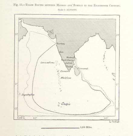
maps from the earth and its inhabitants, vol. viii
trade routes in india
maps from the earth and its inhabitants, vol. xvii
lake champlain
maps from the earth and its inhabitants, vol. xvii
lake champlain
maps from the earth and its inhabitants, vol. ii
maps from the earth and its inhabitants, vol. xvii
coasts of the united states
maps from the earth and its inhabitants, vol. xii
ernst georg ravenstein
maps from the earth and its inhabitants, vol. xvi
colorado river delta
maps from the earth and its inhabitants, vol. xii
las palmas de gran canaria
maps from the earth and its inhabitants, vol. vii
five great mountains
maps from the earth and its inhabitants, vol. xviii
weather and climate of north america
maps from the earth and its inhabitants, vol. vii
ernst georg ravenstein
18th-century maps of bretagne
robert cordier (engraver)
old maps of genoa
nicolò armanino
ducatus sleswici pars borealis
maps by johannes mejer
4401 - 4500 of 7,118
Next page
/ 72